The democratisation of digital maps: How protomaps are changing the game
Protomaps is an innovative open source map technology that is fundamentally changing the way digital maps are created, distributed and used. At its core, Protomaps utilises the ground-breaking PMTiles format – a single-file approach to vector tiles that eliminates the need for a complex tile server infrastructure while increasing performance and reducing bandwidth consumption.
Technical innovation
Unlike traditional solutions that rely on thousands of individual tile files served from a complex infrastructure, PMTiles bundles vector map data into a single, efficiently indexed file that can be hosted anywhere from traditional web servers to object stores with no special configuration required.
This approach enables progressive loading so that maps can be rendered quickly at variable zoom levels while maintaining the rich detail and interactive features that users expect from modern map solutions.
Democratisation
How is Protomaps democratising digital cartography in practice?
Economic accessibility
By eliminating recurring API costs and usage-based pricing models, Protomaps opens up map functionality to projects of all sizes, from hobby developers to non-profit organisations and educational institutions with limited budgets.
Technical accessibility
Leaflet, MapLibre and OpenLayers can be integrated with just a few lines of code and minimal configuration.
Freedom of customisation
Without the styling restrictions imposed by commercial vendors, Protomaps allows complete creative control over the appearance of maps. Maps can be customised in ways that would be difficult or impossible to achieve with traditional services.
Privacy by design
As Protomaps enables fully self-hosted map solutions, there is no need to share user location data or map activity with third parties – a crucial aspect for privacy-conscious applications and those operating under strict regulatory frameworks.
Real-World Applications
Let’s take a look at various applications where protomaps can prove to be transformative:
- Small municipalities
- Cities can replace their commercial mapping system with a Protomaps-based solution to display area information, infrastructure projects and municipal resources. The self-hosted implementation not only eliminated recurring licence costs, but also the ability to add local landmarks and municipal boundaries to the map that were previously difficult to highlight with commercial services.
- Offline map
- Protomaps can enable the creation of offline-enabled mapping tools in areas with spotty or no internet connectivity. By distributing PMTiles files containing detailed local and regional maps, interactive mapping tools can be accessed without the need for constant internet access.
- Privacy-focused applications
- For example, healthcare provider networks can use protomaps to create facility location tools, with user location data stored only on the device.
- Specialised tools for businesses
- PMTiles enables companies to create highly specialised maps with industry-specific symbology and data visualisation that could not be offered by commercial map providers, while ensuring that the maps are accessible on mobile devices even in remote areas without mobile coverage. For example, in forestry, maps with special vegetation and topography layers can be developed for field workers.
Limitations
PMTiles is intended for the web-based display of large, mostly static data sets,
- based on a web platform and not on a local desktop application.
- where the information to be explored totals more than a few megabytes – more than can be loaded at once for a pleasant website experience.
- whose data set changes at most daily or never.
If your application does not have these three features, there are simpler alternatives to PMTiles:
GeoJSON
If you are creating a web-based map with static information, but your data is small, you should provide it as a single GeoJSON file.
With MapLibre, it’s as simple as adding a GeoJSON source.
This saves you the hassle of converting your data into tiles, and you can use the same map design and interaction techniques as you would with tiled data.
PostGIS
If you are creating a web-based map for a large dataset that is dynamic and frequently updated by users, you should store your features in a transactional database.
While it is possible to update a PMTiles file regularly, this requires the file to be reloaded each time it is saved. While this may be fine for daily updates, any higher frequency requires an inefficient amount of data transfer.
PostGIS is the industry standard for transactional geographic feature databases. Popular methods for retrieving tile data from PostGIS are pg_tileserv, martin and the raw function ST_asMVT.
A major challenge for web maps, including PostGIS-based maps, is the generalisation of data for tiles with lower zoom. One method is to selectively omit attribute data in zoom levels to make overviews brighter at lower zoom levels.
GeoParquet
If you are exploring large, static datasets but do not require publication on the internet, you can avoid tiling and visualise the files directly with desktop software.
Tiling with tools like tippecanoe requires the prior calculation of general overview tiles and is designed for retrieving small, optimised pieces of data over the internet. If the network is not the bottleneck and you have your dataset locally, QGIS is an excellent open source solution for visualisation and map creation.
Together with GeoJSON and FlatGeobuf, GeoParquet is a new format that can efficiently store large datasets and is interoperable with open source data tools. The GeoParquet 1.0.0 specification has been supported since GDAL 3.8.0, the GeoParquet 1.1.0 specification since GDAL 3.9.0.
Lonboard
Tools such as Lonboard enable the visualisation of GeoParquet in Jupyter notebooks. It is possible to publish these on the web using hosted notebooks, although transferring tens or hundreds of megabytes results in more latency than tile maps. For local data, however, GeoParquet and Lonboard is a great solution for exploratory data analysis, saving you the trouble of converting to a network-optimised, tiled format.
Future directions
The standard libraries continue to evolve:
- PMTiles
The main library for processing the PMTiles format
- Client-side implementations for JavaScript, Python, Dart , Rust and Go.
- Server-side implementations and pmtiles CLI.
- Integrations with common mapping libraries:
- Protomaps Basemaps
- creates a cartographic ‘base map’ from OpenStreetMap and other data sources as well as MapLibre styles for display in a browser.
- basemaps-flavors
- Map themes and styles.
However, the ecosystem around Protomaps is also growing:
- tippecanoe
- Tool for creating vector tiles from GeoJSON and other geodata formats.
- PMTiles tile inspector
- Tool for analysing and troubleshooting PMTiles files.
- osmextract
- Tool for extracting regional OpenStreetMap data for use with protomaps.
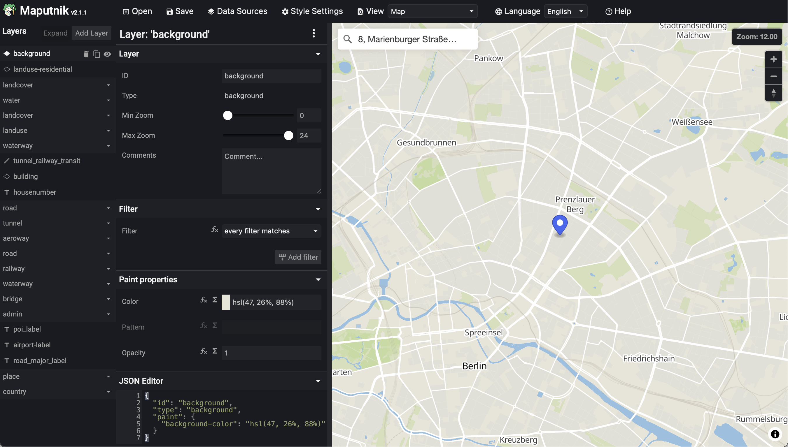
- Maputnik
An open source visual editor for the MapLibre Style Specification and PMTiles sources.
The focus of Protomaps is exclusively tile-based cartography and interactive visualization. However, there are also extensions for geocoding and routing:
- Geocoding
- Routing


